UNTRODDEN PATH 
MOUNTAIN HIKING - NEAR BUDAPEST
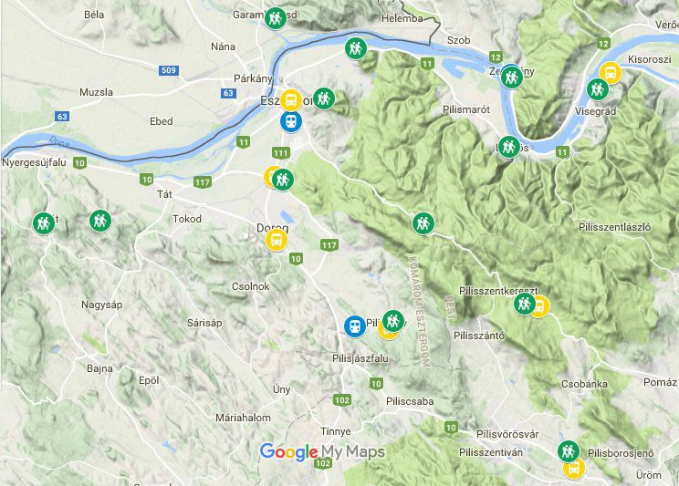
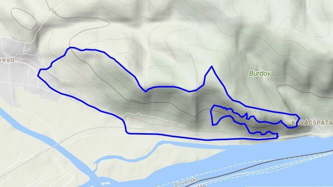
Circle
Starts at Garamkövesd, east end pub
Distance: 10.5 km
Elevation: 780 m
Untrodden: 30%
Difficulty: 4.2 /5
Points of interest:
- Prospect to the Danube and Esztergom
- Many big rocks and exposed cliff perimeters
- Climbing(!) and walking on them
- An interesting collapse cave
- Foothills of those rocks
- Pubs in Garamkövesd or Párkány (SK)
Circle
Starts near Eszetrgom at Adri buffet
Distance: 11.4 km
Elevation: 610 m
Untrodden: 20%
Difficulty: 3.2 /5
Points of interest:
- Nice ledge of rocks
- Kerek lake (drinks & food if open that day)
- Nice ridge up to Maróti mountains
- Sas mountain lookout
- Hideglelős-kereszt peak
- Prospect to mountain range Börzsöny
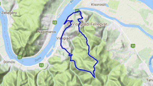
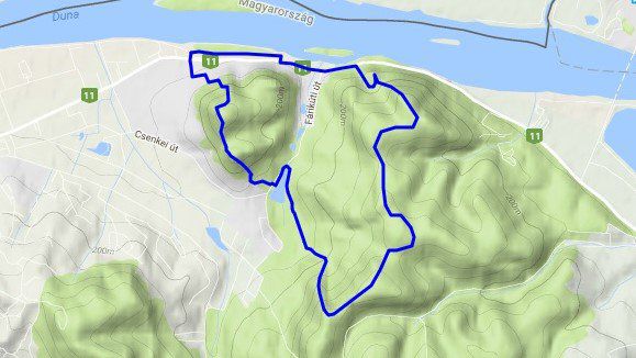
Circle
Starts in Visegrád, northern part
Distance: 18.1 km
Elevation: 1080 m
Untrodden: 20%
Difficulty: 3.8 /5
Points of interest:
- Zsitvai lookout tower (entrance fee)
- Another nice lookout place from a cliff
- Abandoned military base (full of blackberries in late summer)
- Nice long ridge downward
- Fishing & eating (seasonal)
- Visegrád castle (entrance fee)
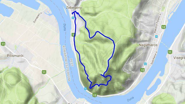
Circle
Starts in Zebegény, railway station
Distance: 10.7 km
Elevation: 760 m
Untrodden: 5%
Difficulty: 3.2 /5
Points of interest:
- Brother Julianus Lookout tower
- Prospect to mountain range Visegrádi
- Scenic mountain sides and rocks
- Artificial small caves
- The nice main square of Zebegény and a great pub
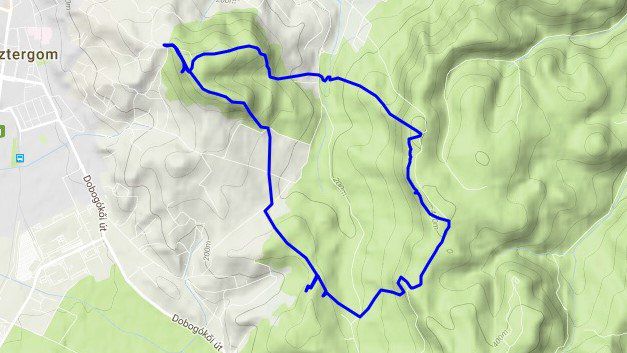
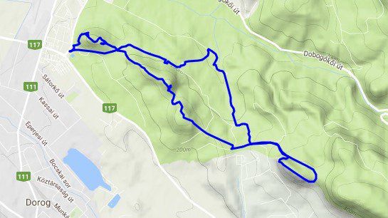
Circle
Starts in Esztergom on the Vaskapu hill
Distance: 13.7 km
Elevation: 680 m
Untrodden: 30%
Difficulty: 3.4 /5
Points of interest:
- Vaskapu shelter hut complex (food & drinks if open that day)
- Many lookout places
- Nice forest parts
- Forgotten military trench beside the nowadays highway path
- Small and Big Loggia volcanic tuff cave
- Hegymeg highland
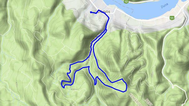
Circle
Starts in Dömös, near the center
Distance: 14.7 km
Elevation: 890 m
Untrodden:15%
Difficulty: 3.8 /5
Points of interest:
- Provostal ruins (entrance fee, seasonal)
- Vadálló cliffs (one of the most interesting row of cliffs around here)
- A needless lookout tower, prospect to the Danube bend
- Southern ridge of Vadálló cliffs (not for tourists)
- Rám ravine
- Árpád fort ruins (almost nobody knows)
There and back
Starts at DINPI house in Esztergom-kertváros
Distance: 13.7 km
Elevation: 690 m
Untrodden: 20%
Difficulty: 3.4 /5
Points of interest:
- Nice rocky ridges all the way there
- Tündérkapu cave entrance created by thermal water activity
- Scenic volcanic plateau invading the lime stone crest
- Underground Soviet bunkers on the way home (1 & 2 stories)
+ Crystal cave tour here.
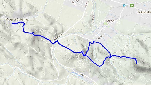
There and back
Starts in Mogyorósbánya, main square
Distance: 16.9 km
Elevation: 1000 m
Untrodden: 5%
Difficulty: 3.4 /5
Points of interest:
- Rock maze of Mogyorósbánya (just get lost in there)
- Nice gardens on the way
- Hegyes-kő hill lime stone layers & lookout
- Nagy-Gete mountain lookout
- Way back through Tokod village
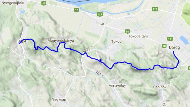
Straight
Travelling from Dorog to Bajót by bus
Starts in Bajót, ends in Dorog
Distance: 19.3 km
Elevation: 1050 m
Untrodden: 10%
Difficulty: 4.0 /5
Points of interest:
- Bajót cliffs with lime stone layers and caves
- Rock maze of Mogyorósbánya (just get lost in there)
- Nice gardens on the way
- Hegyes-kő hill lime stone layers & lookout
- Nagy-Gete mountain lookout
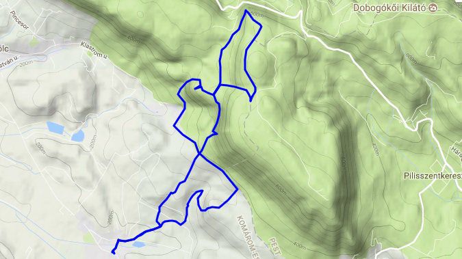
Circle
Starts at Pilisszentlélek, bus turn-round
Distance: 10.1 km
Elevation: 520 m
Untrodden: 25%
Difficulty: 3.0 /5
Points of interest:
- The bigest Pauline monastery ruins around here
- Nice lookout places
- Hirsch summit
- Hamvas-kő cliff for deers
- Fehér-szikla ledge
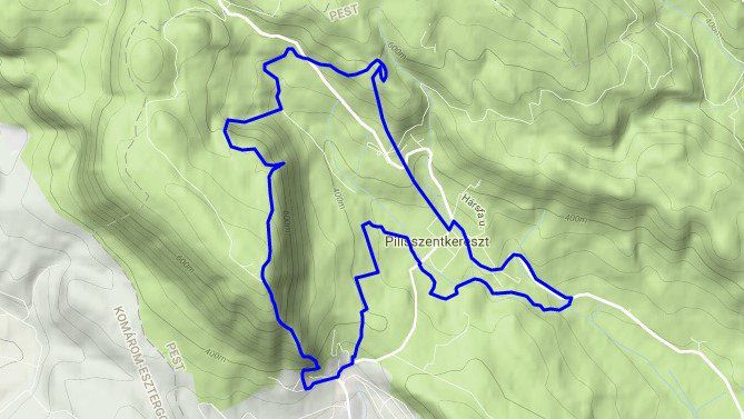
Circle
Starts in Pilisszentkereszt, Dera parking
Distance: 17.6 km
Elevation: 1010 m
Untrodden: 25%
Difficulty: 3.8 /5
Points of intere st:
- Dera gully
- Small ruins of a Cistecian monastry
- Chapel in a stone mine
- Rocky ridge of Pilis mountain to the top (450 m sudden elevation)
- Lookout tower, prospect to mountain range Visegrádi
- Vaskapu rocks with giant ring holes (remains of an ancinet cave)
- Clear transit from lime stone to volcanic stone
- Zsivány-sziklák fracture
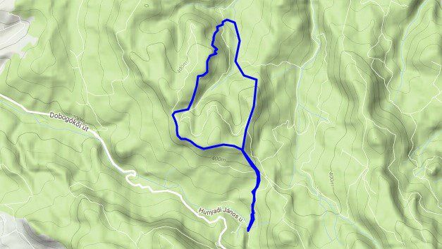
There and back
Starts at Piliscsév, main square
Distance: 16.2 km
Elevation: 780 m
Untrodden: 5%
Difficulty: 3.4 /5
Points of interest:
- Nice little village of Piliscsév
- Small through cave on a ridge
- Kémény cliff
- Nice rocky gully
- Fekete-kő summit that is called Comb (a climbable 140 m abyss)
There and back
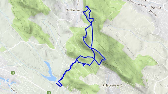
Starts near Solymár, Háziréti lake parking
Distance: 15.4 km
Elevation: 990 m
Untrodden: 5%
Difficulty: 3.6 /5
Points of interest:
- Sacral 'hivestone'
- Eger castle movie scene
- Nagy-Kevély mountain cliffs, climbing on it across
- Kis-Kevély ridge lookout
- Mackó cave
- Csúcs hill, stone mine waste land
- Oszoly peak lookout

ONLY FOR FANATICS ![]()
Straight
Starts in Budapest at Csillaghegy HÉV stop, ends in Esztergom at Basilica
Distance: 43 km
Elevation: 2250 m
Untrodden: pretty much
Difficulty: tiring
Points of interest:
- A lot through the crest of mountain range Pilis from end to end